InfrastructurePartner ContentWed 20 May 20
Keep Your Projects Running, From a Distance
Technology that allows for virtual site inspections has provided construction and engineering companies with an edge during government-ordered shutdowns and social distancing.
High-resolution aerial imagery and 3D content, on-demand from "deep-tech" pioneer Nearmap, is part of the workflow for some of Australia’s largest construction companies, helping power them through the development lifecycle.
Nearmap captures more than 446,000 square kilometres—covering 89 per cent of the Australian population—so companies can check almost any location in an instant, with measurable detail that’s unavailable from free satellite images.
Reliably up-to-date, Nearmap lets these companies understand what’s happening on site and, given travel restrictions associated with coronavirus, has become an essential way to keep projects moving.
Cardno digital technology manager Liz Fulton said that Nearmap has helped Cardno through the Covid-19 pandemic.
Fulton is part of a team supporting 4000 staff globally, ensuring the best possible tools are available to the global infrastructure and environmental consultancy, engineering and development business.
“We have not had to change the operating environment to support Nearmap. There have been other software and systems that we’ve needed to ensure staff can access, but not this product.
“So, from a business infrastructure viewpoint, this aspect of Nearmap has been really helpful.”
Nearmap has an "as-a-service" business model, which has revolutionised the business of aerial imagery.
The Australian-developed proprietary camera technology achieves captures at 80 per cent higher resolution than satellite mapping. The imagery is processed quickly and made available online, no additional software required.
"For decision-makers, this means there's no need to worry about complex IT infrastructure, no need to think about how to deal with imagery storage,” Nearmap director of global product marketing Angela Catalan said.
“Teams can simply plug and play the latest content into their respective workflows - whether that’d be vertical imagery, obliques or our range of off-the-shelf 3D content.”
The detail provided is reliably up-to-date, as some areas are flown up to six times a year to keep up with fast-growing communities.
“From the moment of capturing imagery from above, to customer getting access to content, is a matter of days, not months.”
Measurable competitive edge
Limited site access needn’t stop the informed decision-making required at each stage of the project development lifecycle, from concept to completion and beyond.
At the early stages of the project, when site access isn't always possible, getting visibility can help a developer decide whether the project is worth their effort—and, if it is, Nearmap will ensure the concept reflects the latest truth on the ground.
Matching urban terrain to scale, Nearmap allows for accurate measurements of structures remotely, from the pitch of a roof to the height of a skyscraper, to determining the space between buildings.
It’s important to quickly measure the size of the land parcel, slope, and heights of surrounding buildings and objects, Catalan explains.
"These features enable them to figure out if the land is worth buying, for how much, what’s the return on investment, and so on. This is crucial, as sometimes they only have a couple of days to make a decision on a purchase," Catalan said.
3D for proposals and design
Companies using Nearmap are often able to outpace competitors, responding to opportunities more confidently and quickly.
Architects and engineers can overlay designs on real-world imagery and visualise in both 2D and 3D. The heights of surrounding buildings can be measured, along with line of sight for views from top floors and roof.
"Having the ability to explore 3D content in MapBrowser, then within minutes, export content for detailed design inside third-party application reduces the hours required in building conceptual models," Catalan said.
"The sooner they can visualise the world in 3D, the sooner they have the ability to ‘wow’ their clients and communicate better."

Deeper location understanding
Nearmap provides perspective and versatility: measure up, construction phases, traffic rerouting—the possibilities are endless, Catalan says.
Even while working remotely, that includes being able to view current site access for heavy vehicles, materials delivery, planning of crane design, clearance, and placement.
Nearmap can assist with everything from estimating building materials requirements to managing stakeholder engagement. In fact, different stages of the construction project can be illustrated to give the client confidence that their decisions are based on the reality on the ground.
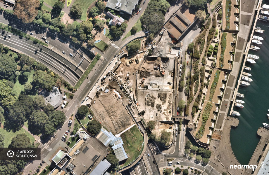
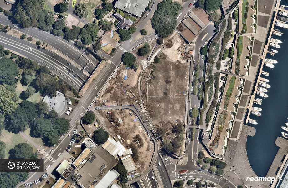
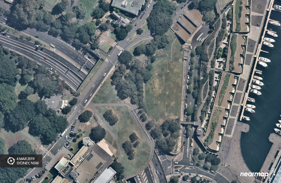
Catalan says while Nearmap takes pride in being up-to-date, its wealth of historical content is truly valuable to anyone who needs a deeper understanding of their site. Being able to view and compare captures from different survey dates, right in the browser, is as close as one can get to time travel.
"In Australia, we have over 10 years of content in some areas so we're second-to-none when it comes to providing an understanding what can be built based on local urban planning policies and the like—all of this makes that first site visit more valuable.”
Nearmap NAVIG8 is the annual event where Nearmap customers from around the world share their experience and insights.
Click here to register.
The Urban Developer is proud to partner with Nearmap to deliver this article to you. In doing so, we can continue to publish our free daily news, information, insights and opinion to you, our valued readers.


