
Sponsored ContentPartner ContentFri 16 Apr 21
Bring New Levels of Reality to Projects
Digital transformation can be a bit of a buzzword. It can also infer massive change that many organisations aren’t quite ready to tackle.
But transformation isn’t an all-or-nothing proposition. It doesn’t need to be an intense, overnight overhaul or a complete break with tradition.
Successful evolution means embracing digital tools and processes when and where it makes sense for your company—and for each project you take on.
Here are key things to keep in mind as you gear up to elevate industry standards, on your terms, according to Nearmap.
Don’t sell yourself—or your clients—short
One positive outcome of the pandemic is more fluid collaboration between clients and stakeholders. With fewer physical boundaries limiting discussions to select channels, architecture, engineering and construction (AEC) companies are pioneering newer methods to convey planning concepts.
Arcadis, a leader in built and natural asset design and management, has developed visualisation tools to reflect our 3D reality, as opposed to creating a false approximation of natural surroundings. This approach makes it easier for clients to insert themselves into various project locations for virtual site visits.
We live in a three-dimensional world so why limit designs to two dimensions?
Arcadis draws on multiple applications, including 3D imagery from Nearmap, to supplement the natural environment and deliver a real sense of placement for people who aren’t necessarily from the engineering community.
Then, when appropriate, they can animate static images, adding in pedestrians and vehicles to further bring scenes to life. The BIM environment can also deliver a holistic view of ongoing construction updates to stakeholders in multiple geographic regions.
As a digital deliverable, this single source of truth opens up opportunities for firms by widening the talent pool.
Traditionally teams get assigned to projects based on proximity, but by embracing digital tools you can involve the best person for a job—not just the person who is closest.
Measure twice and cut once
When dealing with a multi-staged construction site project, you don’t want to progress so far along in planning that when you get there something is missing.
Achieving a life-like vision doesn’t have to be expensive and can actually be more cost-effective, especially if you’re organising a field visit or bespoke survey flight during the planning stage. Before you send multiple engineers to a project site or order a LiDAR mission, make sure you have the latest data.
For assignments that require absolute accuracy, you might need a bespoke flight solution for dedicated survey mapping. But you can cut down on the number of times you conduct flythroughs by augmenting image captures with continually refreshed data from Nearmap.
Latest research shows that around half of all builders use BIM in project planning and visualisation, and more than 60 per cent use it to assist with clash detection. It can save you from making costly mistakes that can get in the way of you getting the job done.
Combining BIM with GIS can help you to mitigate risks, save time, meet specifications, and simplify processes without compromising quality or compliance.
Expand your horizons
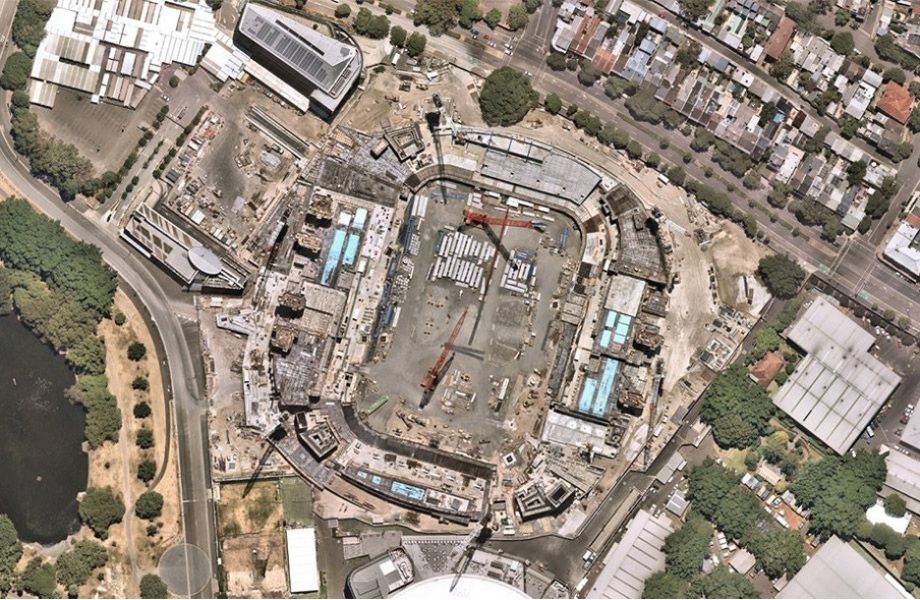
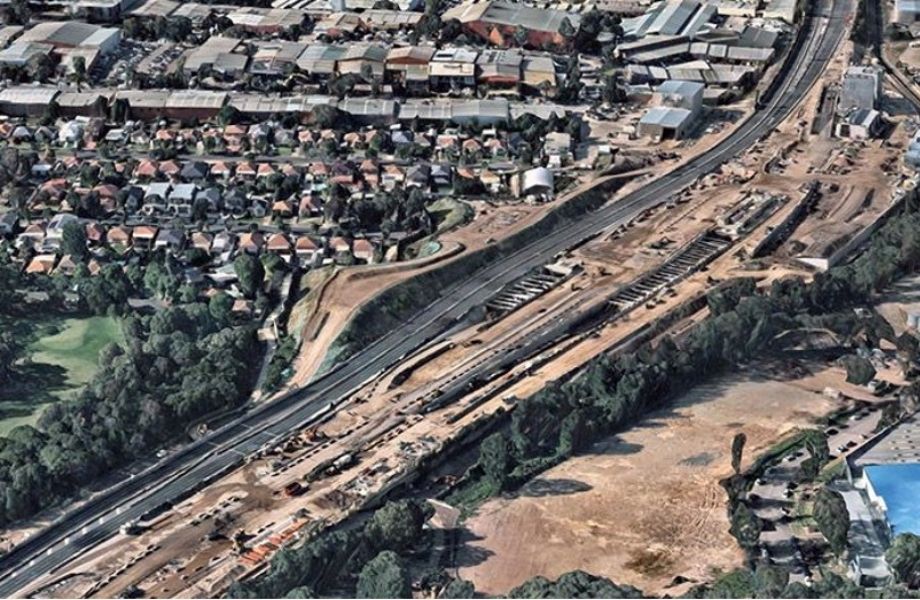
Some projects require working around restricted areas, such as busy airports in densely populated urban areas.
When flyovers are prohibited, AEC firms rely on historical data to understand the challenges a location may face at different times of year, and how the landscape changes over time.
This makes it difficult to determine, for example, how to ensure a relocated airport taxi rank won’t negatively impact traffic flow during construction, or how to best plot train replacement buses. With Nearmap, you can explore without limits. Unprecedented high-fidelity content with wide-scale coverage across major urban and regional areas in Australia gives you the scope to plan and estimate confidently.
Many AEC firms are building for a new world using old-world methods. If you want to create architectural concepts that bring your vision to life, along with a detailed construction plan, you must take advantage of the new technologies around you.
Building information modelling (BIM) delivers a detailed 3D view of the built environment to document and verify designs, so you can quickly visualise the building and the impact of decisions before breaking ground and generating design documentation for construction management.
The Urban Developer is proud to partner with Nearmap to deliver this article to you. In doing so, we can continue to publish our free daily news, information, insights and opinion to you, our valued readers.


