InfrastructureVanessa CrollWed 22 Oct 25
Pyrmont Planning Overhaul to Reshape Sydney’s Inner-West

As tunnel boring machines carve space beneath one of Sydney’s inner peninsulas, above ground the city’s western edge is undergoing its biggest planning overhaul in recent history.
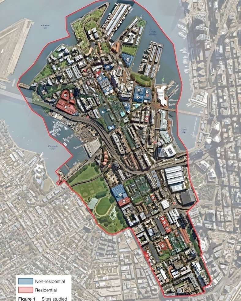
The City of Sydney will vote next week on the Ultimo-Pyrmont Peninsula Strategy—a framework unlocking up to 4800 homes and 27,000 jobs across 142ha between Broadway and Pirrama Road.
About 15ha near the Pyrmont Metro site and Harris Street would gain height and density through new mixed-use zoning.
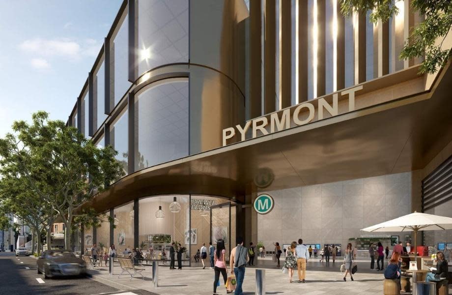
The station, under construction between Pyrmont Bridge Road and Union Street, will anchor the peninsula’s next phase of renewal.
Sydney Metro confirmed this month its tunnel boring machines, Jessie and Ruby, “have successfully broken through into the Pyrmont Station Cavern” and are now heading toward Hunter Street, carving the underground route linking the inner west to the CBD.
Prepared in partnership with the NSW Department of Planning, the framework converts the Pyrmont Peninsula Place Strategy from a state vision into detailed local planning controls, following three years of technical work.
According to the city’s report, it “balances housing delivery and job creation” and will “reinforce Pyrmont’s role in the innovation corridor connecting to Central”.
Much of Ultimo-Pyrmont still reflects older planning controls under Sydney LEP 2012, a mix of commercial, mixed-use and enterprise zones.
The area combines mid and highrise apartments with converted warehouses, education buildings and creative offices, while pockets of heritage housing remain around Harris and Fig streets.
Under the new framework, height and floor-space limits would lift, allowing mixed-use projects combining apartments, workspaces and ground-floor retail.
The biggest changes would be around Harris, Wattle and Bank streets, where light-industrial sites could make way for denser, Metro-linked development.
The major redevelopment potential sits across two key areas—1-33 Saunders Street near the future Metro station and 20-28 Bulwara Road in Ultimo—identified for new mixed-use projects
Rezonings at Saunders Street and Bulwara Road pave the way for larger mixed-use towers, while new floor-space bonuses near the Metro favour projects retaining commercial use.
Developers taking advantage of the uplift would contribute more.
A 3 per cent levy would apply to projects above $1 million, aligning Ultimo and Pyrmont with Central Sydney.
An additional 9 per cent affordable housing contribution targets only the extra residential space created through rezoning.
City modelling predicted the system could raise about $148 million for local infrastructure by 2041 to fund new parks, upgraded streets and community facilities.
The final framework raises capacity from the 2024 draft’s 4000 homes and 23,000 jobs, now targeting 4555-4817 homes and 23,637-27,004 jobs.
The post-exhibition process drew 243 submissions, including 148 objections, prompting the city to reduce some heights, refine overshadowing and view-corridor controls.
The plan also identified a Stage 2 investigation with potential for a further 1300 homes.
Renewal would occur through incremental redevelopment of ageing commercial and warehouse buildings alongside infill mixed-use projects on underused parcels.
The framework doesn’t rely on broad-scale demolition or compulsory acquisition.
Broader footpaths, new green links and more than 250 new trees are proposed to connect the peninsula with the wider CBD.
Height and density increases near the Metro are expected to draw private investment in mixed-use projects, with strong potential for build-to-rent and office-led developments close to transport.
The Metro station is due to open in 2032 alongside Metro West, positioning the peninsula for a decade of renewal.
Council endorsement next week would send the strategy to the planning minister for sign-off, with new planning controls expected to take effect in 2026—clearing the way for the first development applications soon after.


